
Hometowns and villages sinking to the bottom of the lake due to construction of dams and other factors…. . We still hear such stories in many places today.
However, many people currently living at the bottom of what was once the bottom of a lake. Now that would not be something you hear everyday.
What if it were here in Japan, in the center of a certain prefecture, in almost the entire area?
We have actually confirmed such a mystery with our own eyes.
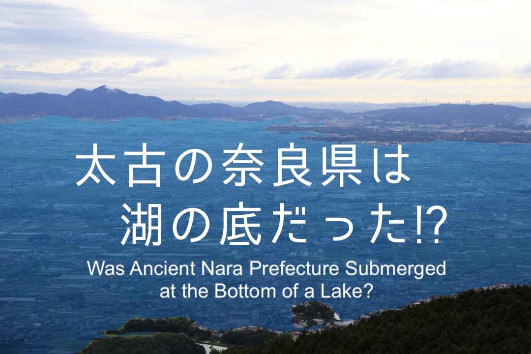
Nara Prefecture was once a ‘lake’!
As you know, the center of Nara Prefecture overlaps with the Nara bonchi (盆地) (Yamato bonchi).
The Nara bonchi is about 15 kilometers from east to west and 30 kilometers from north to south. It is roughly rhombus-shaped.
The Ikoma (生駒) Mountains, including Mt. Shiki (信貴山), and the Kongo (金剛) Mountains, including Mt. Katsuragi (葛城), make up the left side of this rhombus, and the Kasagi (笠置) Mountains make up the right side. The entire rhombus is surrounded by mountains of about 500 to 1,000 meters above sea level, which is the Nara bonchi.
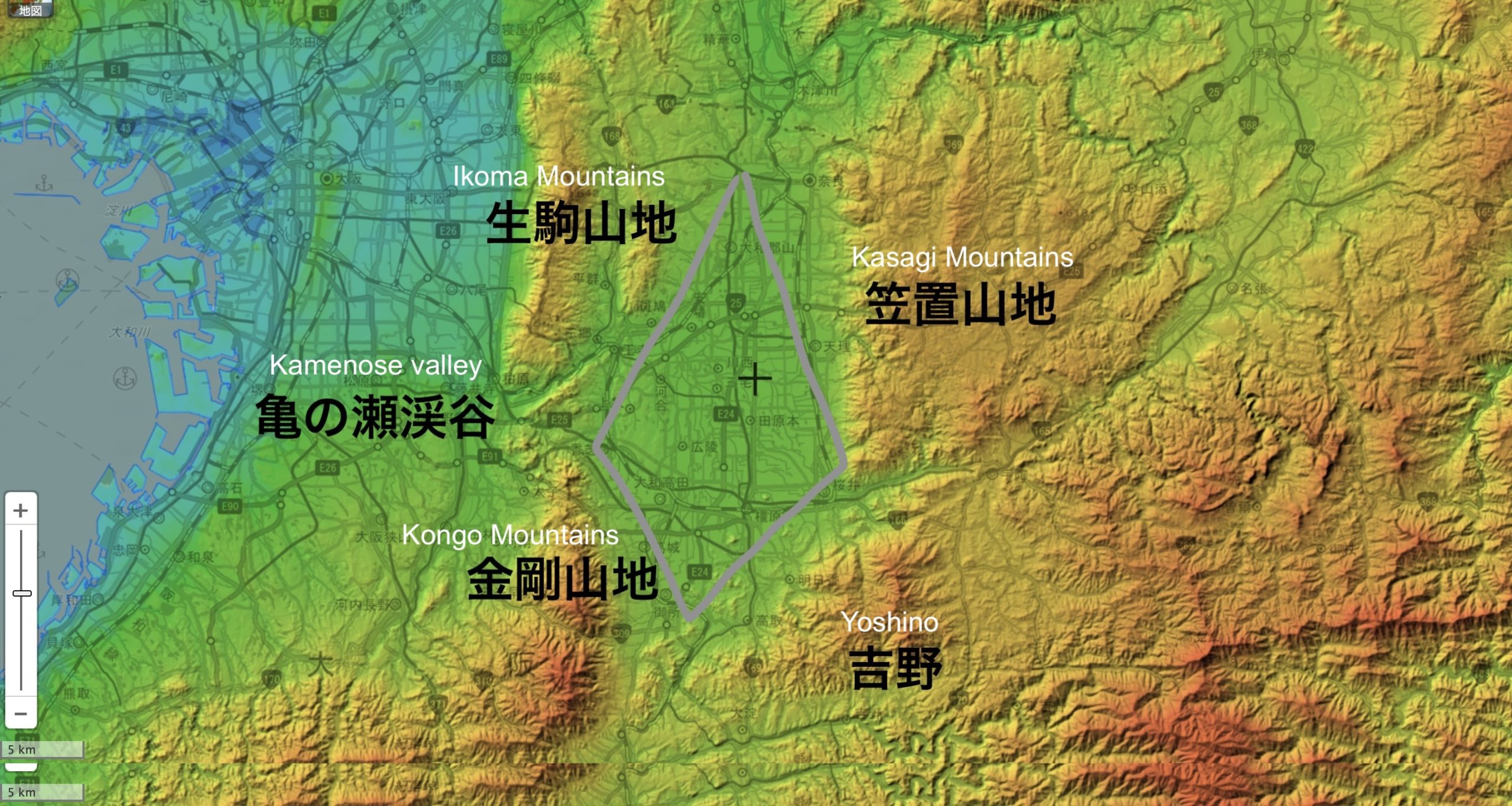
In addition, the Kizu (木津) River, which leads to Kyoto, flows toward the top of the rhombus.
The Saho (佐保), Tatsuta (竜田), Furu (布留), Hase (初瀬), and Katsuragi Rivers radiate from the center of the rhombus, forming the ‘Yamato River System’.
This Yamato River crosses the Osaka Plain through the ‘Kamenose Valley (亀の瀬渓谷)’ in the left corner of the diamond shape, a break between the Ikoma and Kongo mountain ranges, and empties into Osaka Bay.
Let us look at the Nara Bonchi with the ‘Geological Map Navi’ of the National Institute of Advanced Industrial Science and Technology (AIST).
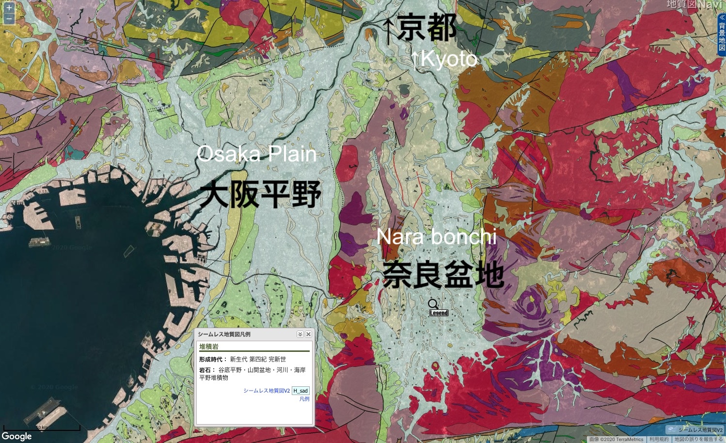
If we look at the geology by color, we can see that most of the Nara Bonchi is light gray in color and formed by sedimentary rock during the Holocene period (about 10,000 years ago to the present).
This geology is the same as that of the Osaka Plain, which faces Osaka Bay on the west side across the Ikoma and Kongo Mountains.
In other words, the same soil composition as the sea and river sediments that make up the Osaka Plain can be found in the Nara Bonchi.
Verified by flood simulation
Now, if the Nara Bonchi had been under water, what would the lake have looked like?
I would like to use a flood simulation using OpenStreetMap, an open-source data tool, to show a large amount of water flowing through the area (sorry, Nara).
If we let the sea level rise until the Osaka Plain is submerged, we get this.
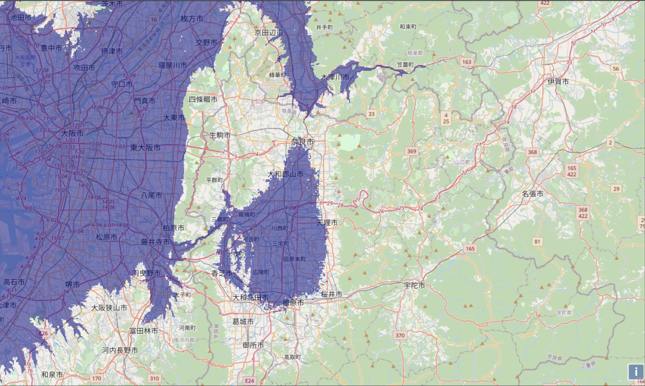
This is …… indeed a ‘lake’!
In archaeology and geology, it is estimated that the so-called ‘ancient Nara Lake’ or ‘Yamato Lake’ was roughly like this.
Although this is a simulation of the sea level rising to the level of sinking Japan, it shows that if the Osaka Plain is submerged, the Nara Bonchi, which is supposed to be surrounded by high mountains, will also be submerged.
Ruins show traces of ‘Nara Lake’
Overlay the locations of Paleolithic to Jomon (縄文) Period sites in Nara Prefecture on this simulation diagram.
Then, we can see that the ruins remain along the shores of this large lake.
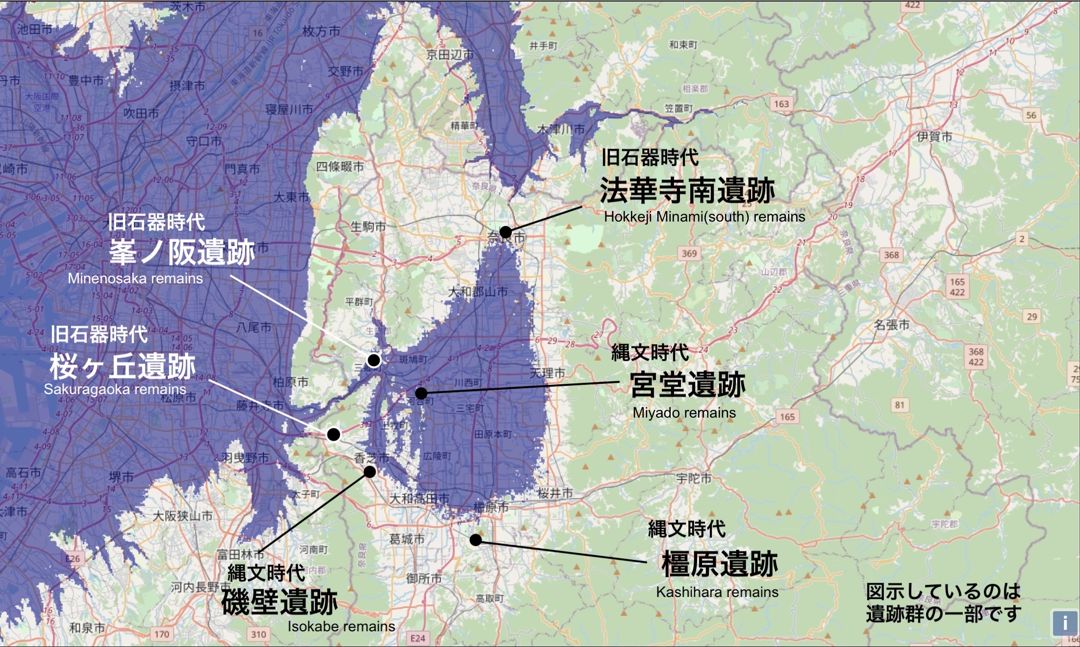
Later, in the Yayoi (弥生) Period, many ruins were built in areas that were once under the surface of Lake Nara.
In other words, Lake Nara existed until the end of the Jomon Period, but the water gradually receded and dried up, and in the Yayoi Period, the lake became smaller or remained as a swamp, where agriculture was carried out.
According to Senda Masami, a researcher who has continued empirical fieldwork on the Nara Bonchi, the top of the rhombus originally opened toward Kyoto and was a sea bay integrated with Osaka Bay. At the end of the Pleistocene (2 million to 10,000 years ago), it was cut off from the sea and became Lake Nara ( Senda Masami, ‘Nara bonchi no keikan to hensen (奈良盆地の景観と変遷 : Landscape and Transition of the Nara Bonchi’, Yanagihara Shoten, 1978).
Later, it is thought that a fault caused a depression near Kamenose, and water began to drain away toward the Osaka Plain, gradually drying up. Mr Senda estimates that ”the surface of Lake Yamato was around 70 meters before 6000, but then gradually declined to around 50 meters before 2500′ (ibid.).
Did the ‘oldest road in Japan’ run along the shores of a lake?
By the way, Nara holds the title for various ‘oldest in Japan’.
The oldest wooden building in Japan, the oldest Buddhist statue in Japan, the oldest shrine in Japan, the oldest market in Japan, and so on. In terms of the number of ‘oldest in Japan’, Nara probably has the largest number of records.
Among them, there is in fact one such record it holds.
‘The oldest existing road in Japan’.
It is an ancient road called ‘Yamanobe no Michi (山の辺の道)’. It appears in an article by Emperor Sujin in ‘Nihon Shoki (日本書紀)’, and is considered the oldest road (official road) in existence.
Today, the path from Miwa (三輪) to Ishonokami (石上) Shrine in Tenri (天理) City, Nara Prefecture, still remains. Recently, a 16-km hiking course has been established from JR Sakurai (桜井) Station to Tenri Station. It is a hidden and popular course that many hikers follow, as it retains the appearance of ancient times.
Although it is not possible to clearly trace the path back then, a map showing the route of the Yamanobe no Michi as it exists today looks roughly like this.
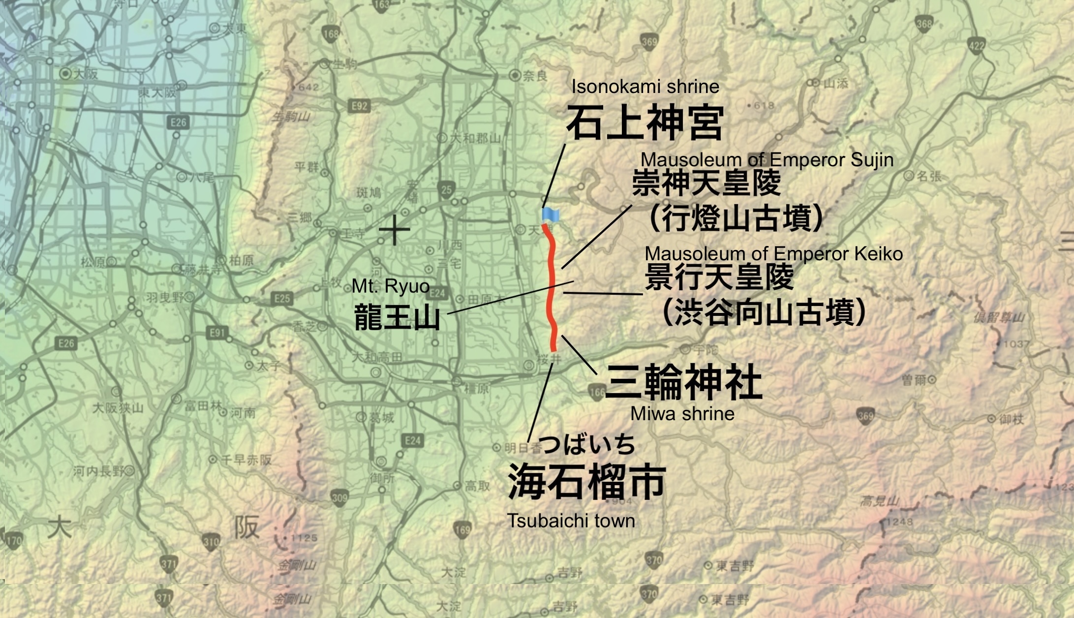
It is believed to have led from Tsubaichi (海柘榴市) in the south, through Miwa Shrine, the Keiko (景行) and Sujin (崇神) Emperor’s mausoleums, through present-day Tenri City, and possibly to Nara.
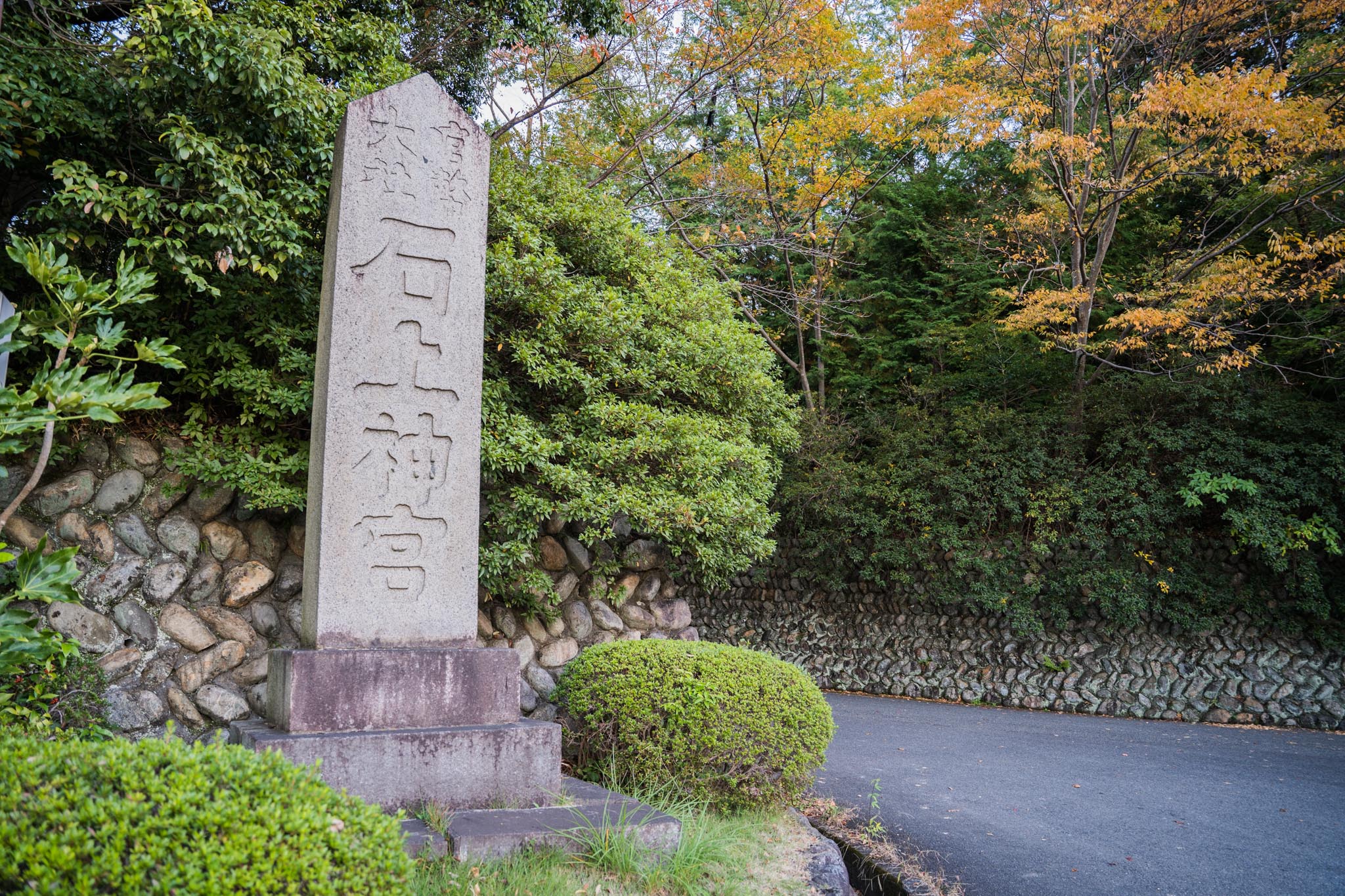
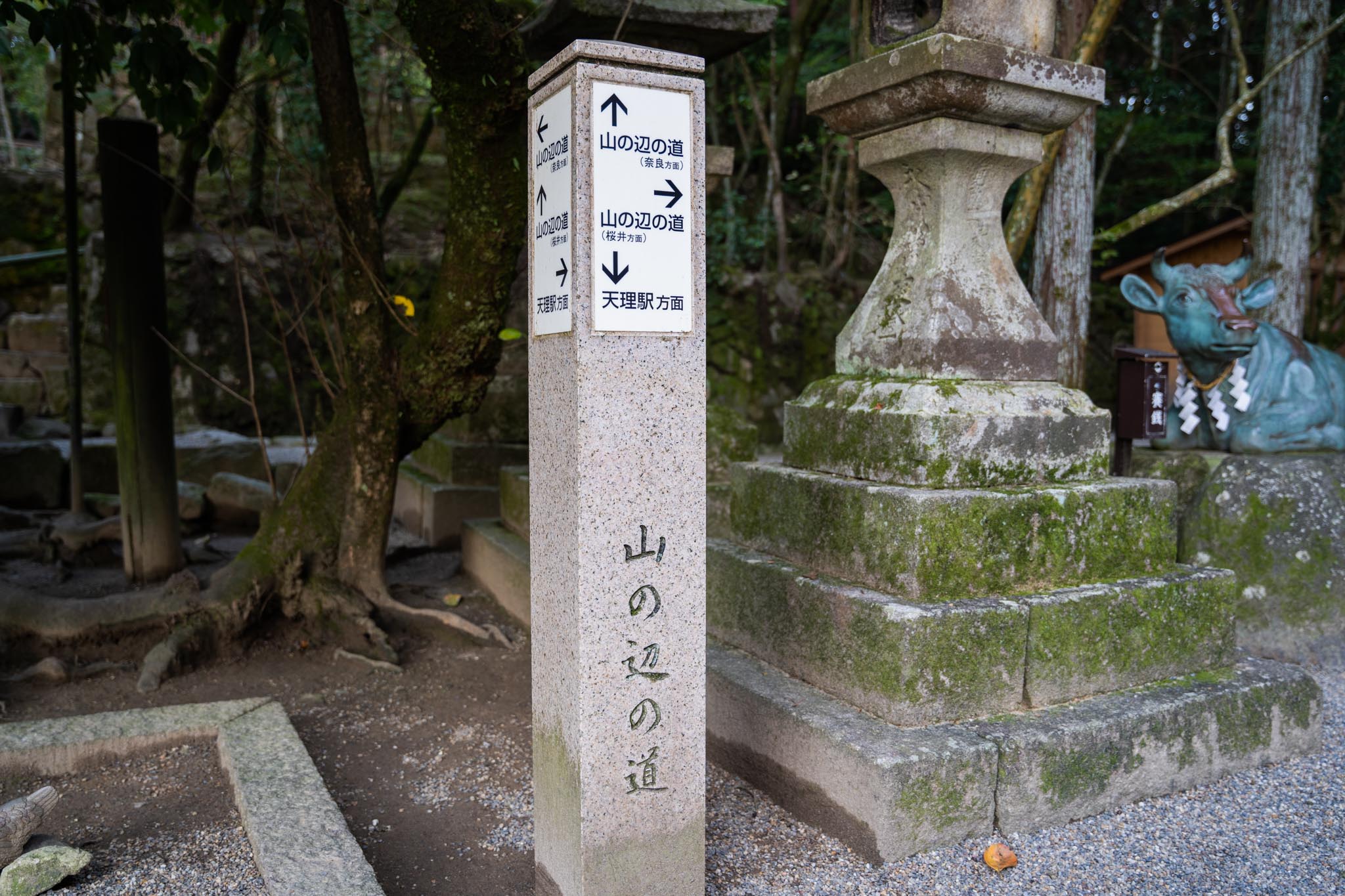
Today, the northern end of the Yamanobe no Michi extends to Isonokami Jingu Shrine, which is also the starting point for hiking trails. From this Isonokami Jingu Shrine, we walked along this path for a short distance.
The starting point is this Isonokami Jingu Shrine.
Just beside the worship hall, a national treasure, and the tower gate, an important cultural asset, ……
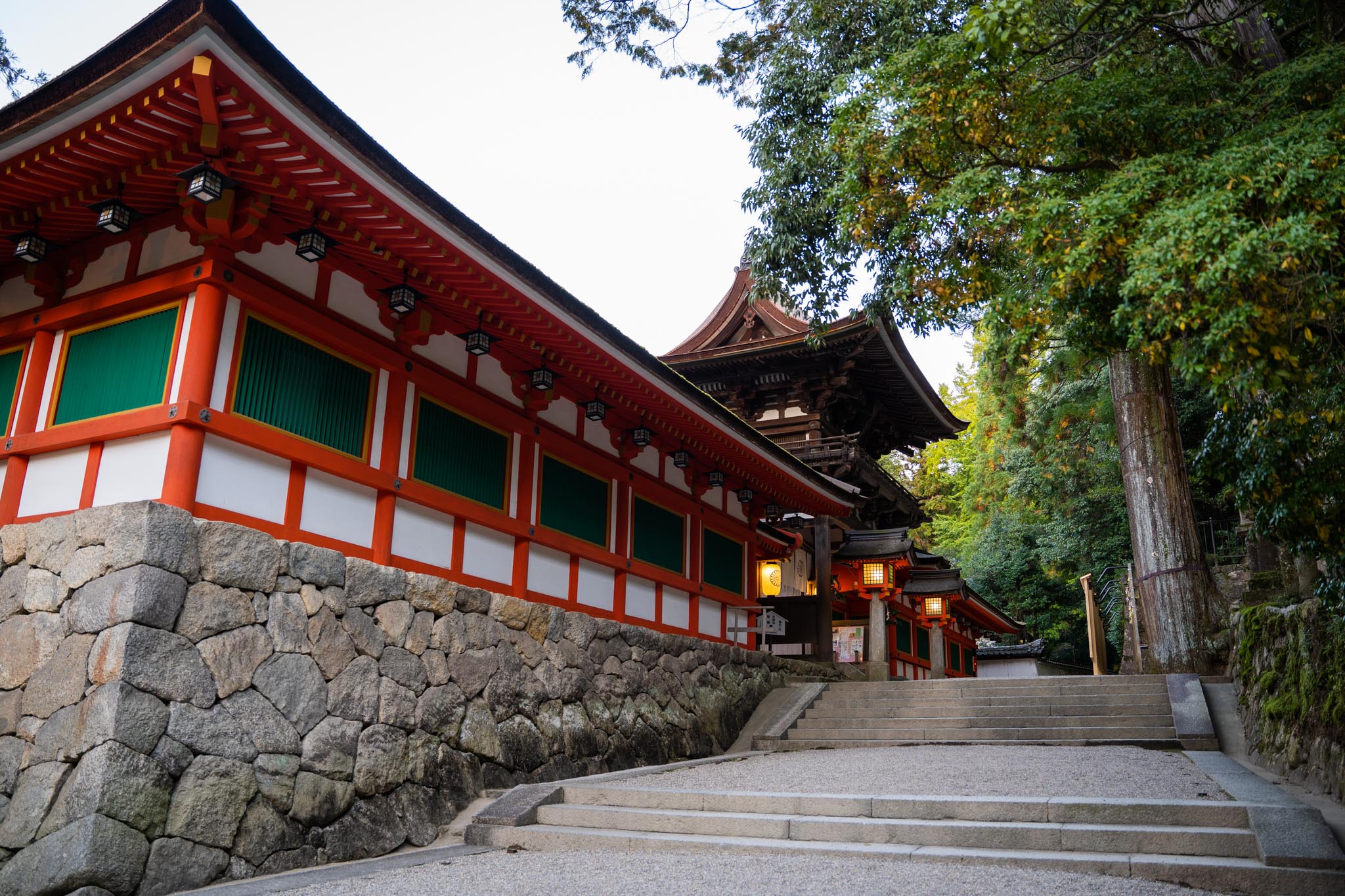
There is a …… starting point.
Immediately a wonderful atmosphere.
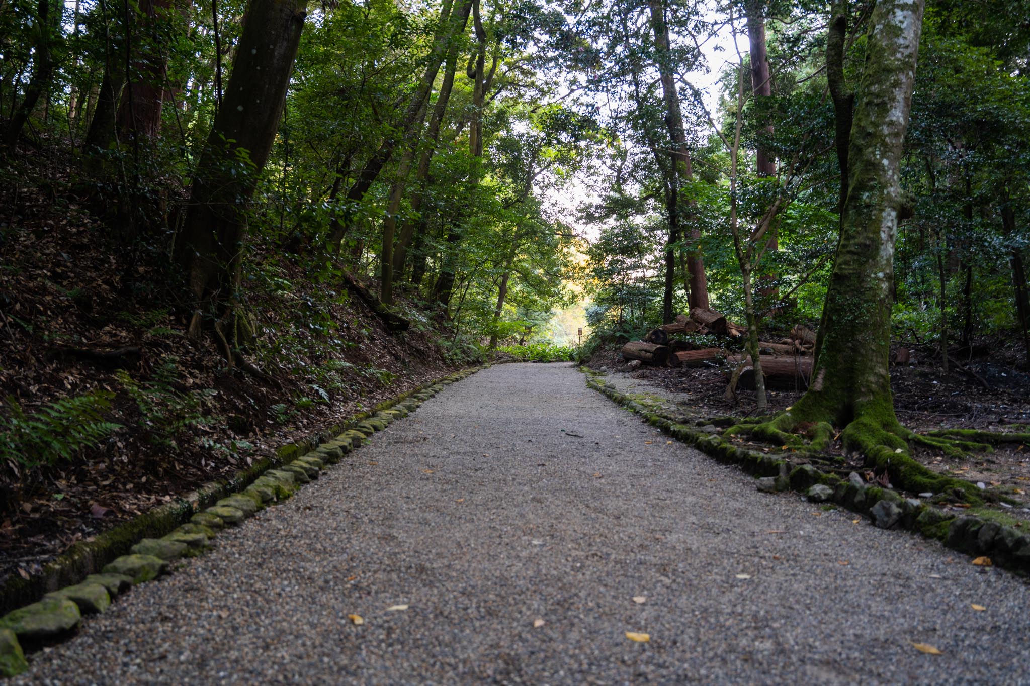
On the way, you will pass through a residential area, but as it is a hiking course, it is quite hilly.
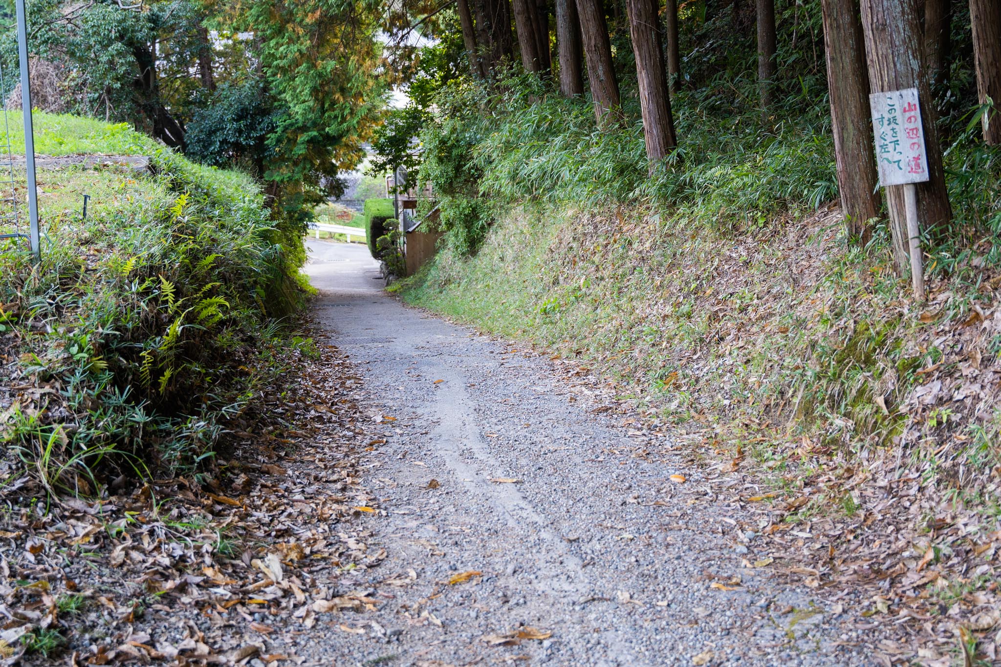
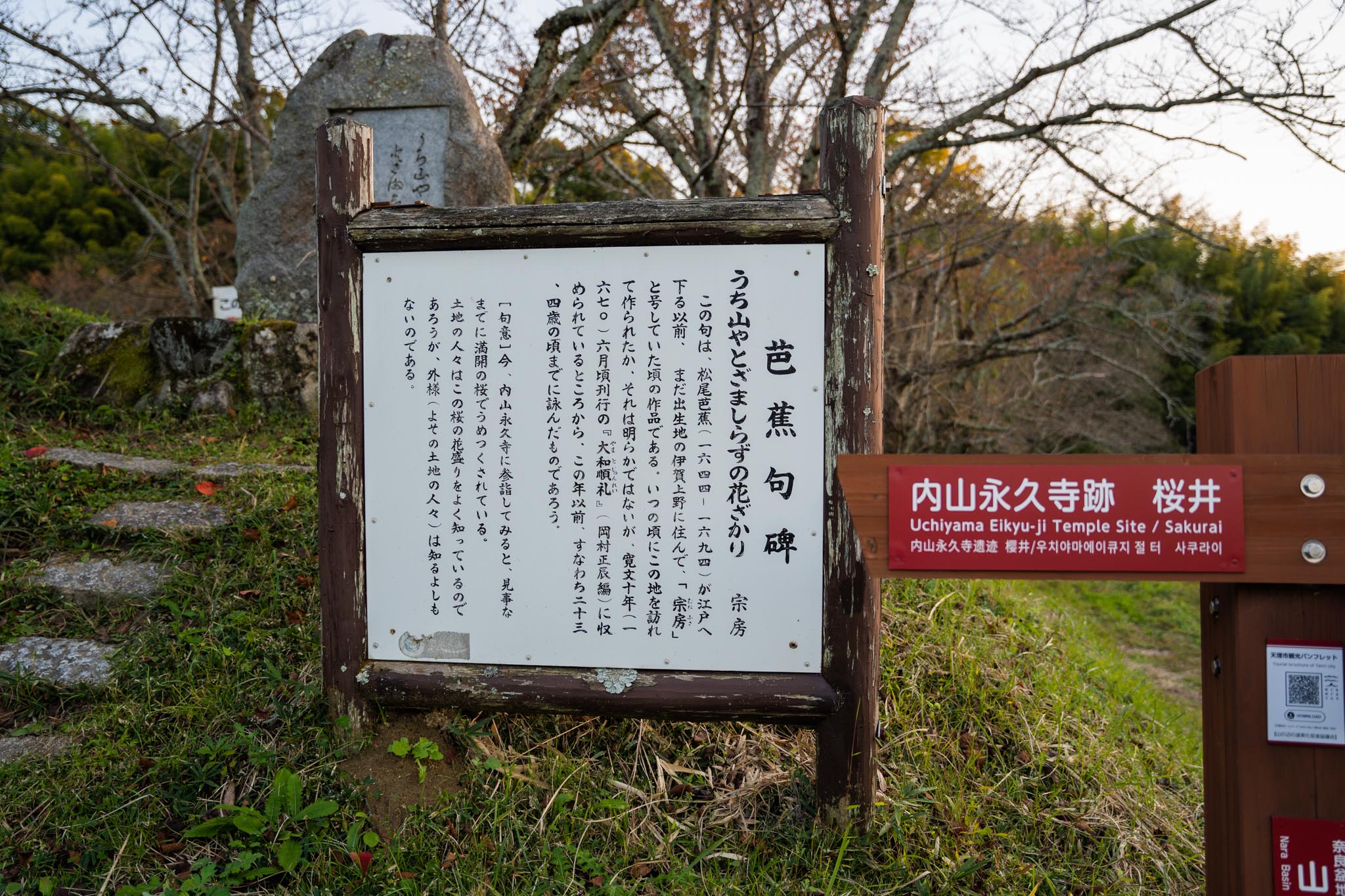
After passing through the persimmon fields, you will soon reach the ruins of Uchiyama Eikyuji (内山永久寺) Temple, a phantom temple that was destroyed during the movement to abolish Buddhism. A monument with a haiku by Matsuo Basho (松尾芭蕉) still remains.

If you continue south, you will pass through a group of ancient tombs, including the tombs of Emperor Sujin and Emperor Keiko, and after about 10 km, you will pass Miwa Shrine in Sakurai City, Nara Prefecture.
On the way south, the left side of the road is always steep mountains. The Yamanobe no Michi runs parallel to the ridges of the mountains, which are over 500 meters high, and leads from north to south.
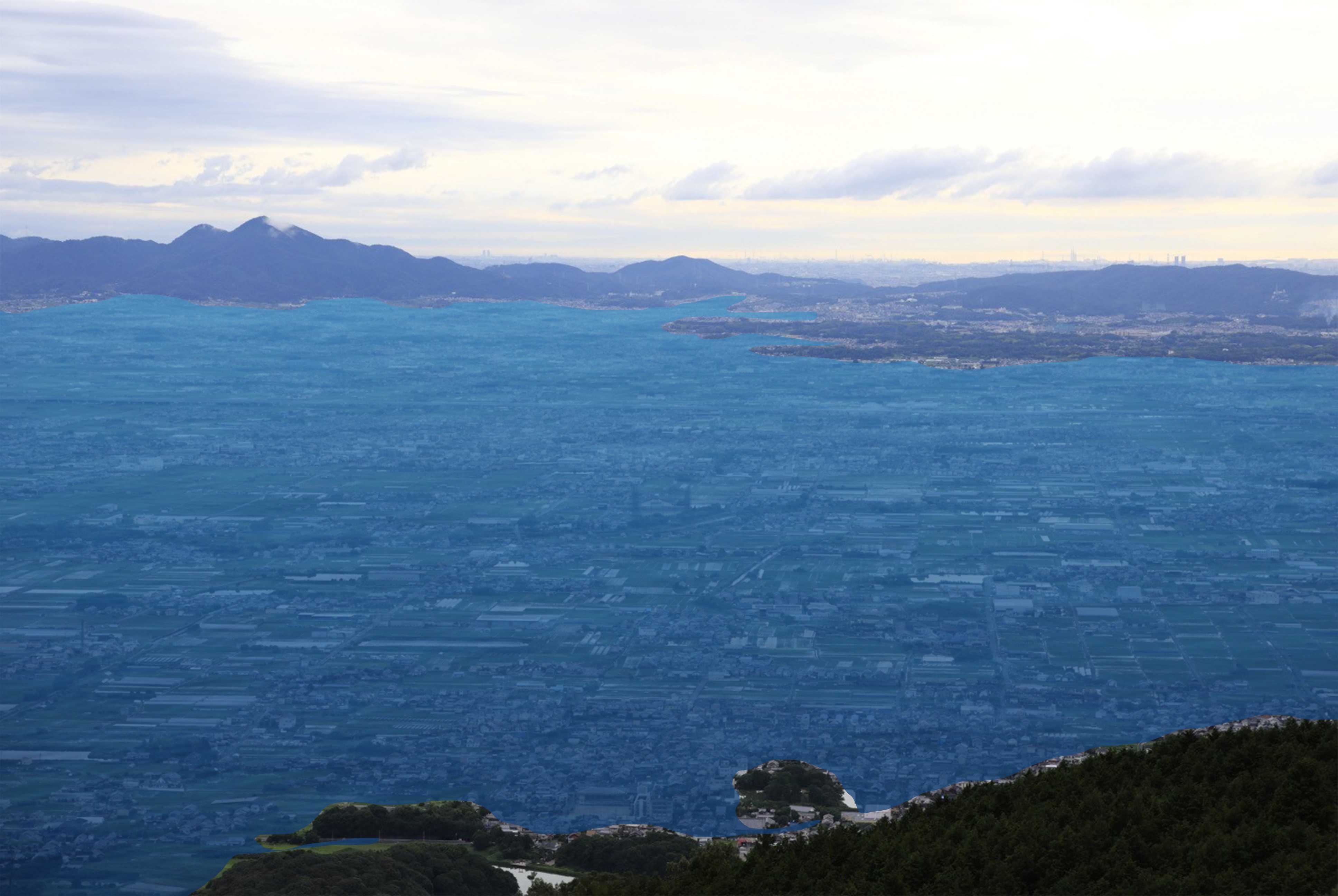
The view from Mt. Ryuohzan
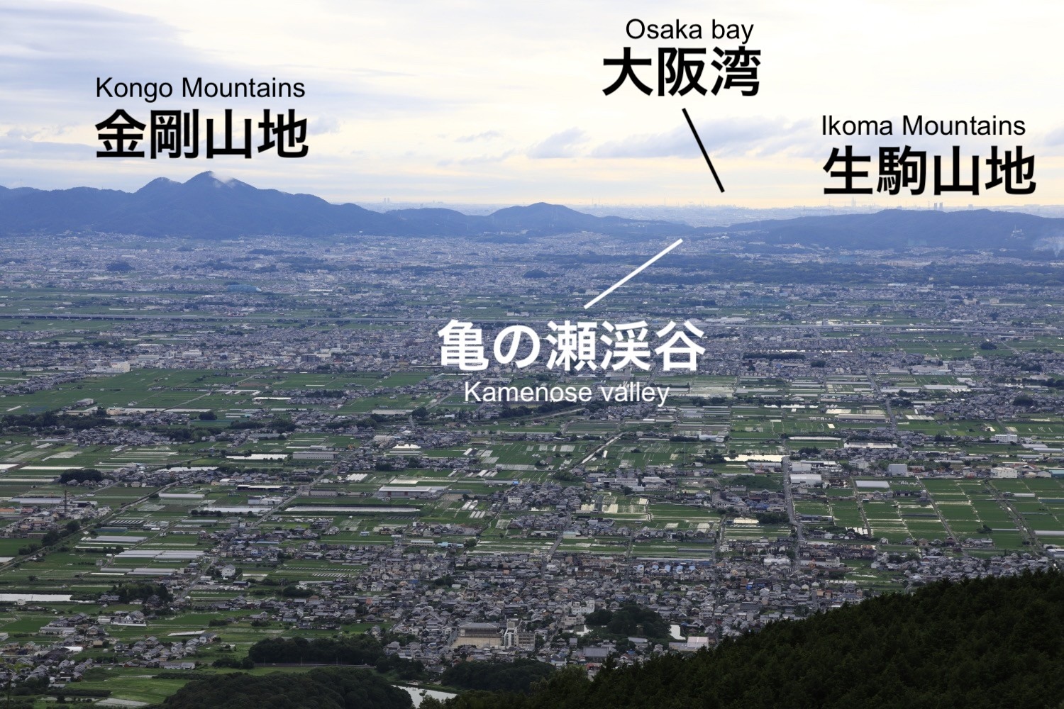
The Yamanobe trail passes through the foothills of Mt. Ryuohzan, where the Toichi (十市) clan, who were once based in this area, built a mountain castle.
Looking directly west from the top of the mountain, one can see Kamenose Valley. On a clear day, Osaka Bay and even the Akashi Kaikyo (明石海峡) Bridge can be seen beyond.
If you look a little further south from there, you can see Mt, Unebiyama (畝傍山), Miminashiyama (耳成山), and Amanokaguyama (天香久山) of the ‘Yamato Sanzan (大和三山)’ can also be seen.
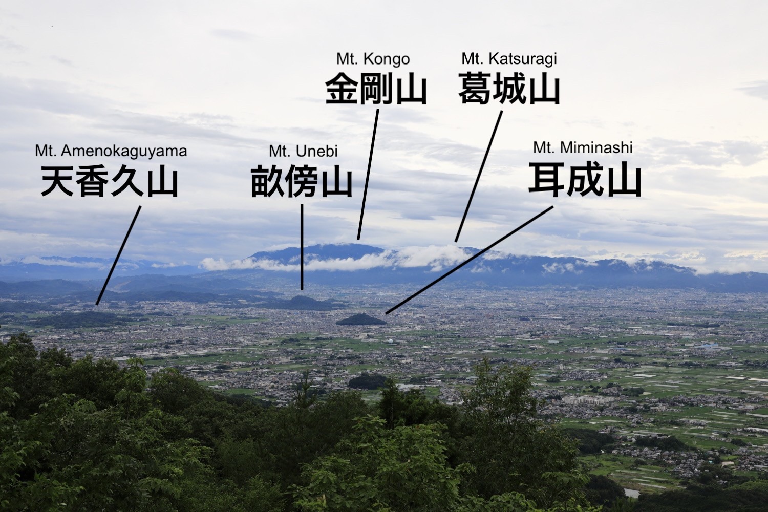
As is often said, these mountains are really kind of endearing, as if they grew out of the ground.
From this view, one can clearly see that the Yamato Bonchi is very flat, and even with a small amount of water, a large area would have been flooded.
Maybe it would have looked something like this.
The view that Emperor Jyomei (舒明) saw
Why does the road running north-south through the Yamato Bonchi go all the way through the undulating foothills of the mountains instead of through a flat area that is easy to walk on?
The reason can be explained by the existence of ‘Lake Nara’. The Yamanobe no Michi runs along the shores of ‘Lake Nara’, and it is thought that there was still water (or a swamp) on the west side of the path when it was laid out.
The existence of Lake Nara is also supported by the fact that there are many mausoleums, ancient tombs, ruins, and old shrines and temples along the Yamanobe no Michi, including the tombs of Emperors Sujin and Keiko. Ancient people probably built their mausoleums and burial mounds avoiding swampy or loose areas.
If the Nara Bonchi was covered with water or was a swamp or marsh, it is not surprising that seagulls flying from between the Ikoma and Kongo mountain ranges caught the attention of Emperor Jyomei.
Nobori tachi Kunimi wo sure ba (If you climb up and look at the country 登り立ち 国見をすれば)
When he stood on Mt. Amanokaguyama and composed this poem, the shimmering surface of the water was still spread out here and there in the Yamato Bonchi beyond the sight of Emperor Jyomei.
The people cultivate the good soil brought by the abundance of nutritious water, plant crops, and make a living.
The smoke rising from the hearths of the houses shows the richness of life in the area.
When I was thinking of these people, I looked up and saw a pure white seagull flying soundlessly high in the sky.
Had it flown all the way down to us through the valley of the Kamenose ?
Oh, how rich this land is….
–Is it a convenient interpretation to imagine such an image of Emperor Jyomei quietly looking out over the land of Yamato?
Although there are many theories, what we can say for sure is that there are still many mysterious stories in the Yamato area that hold mysteries, but also offer a glimpse into the lives of the ancient people.

This article is translated from https://intojapanwaraku.com/rock/culture-rock/133249/
Ando Totonou
Born in 1986. I’m either writing about something or getting other people to. I also run a small company whose main business is “Gagaku (雅楽) x Inbound,” but my daily battles are with cats and pigeons that have made themselves at home in my house. Recently, I even feel a strange friendship blooming with them.